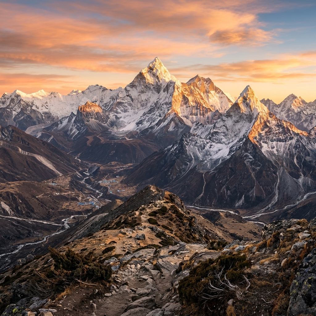
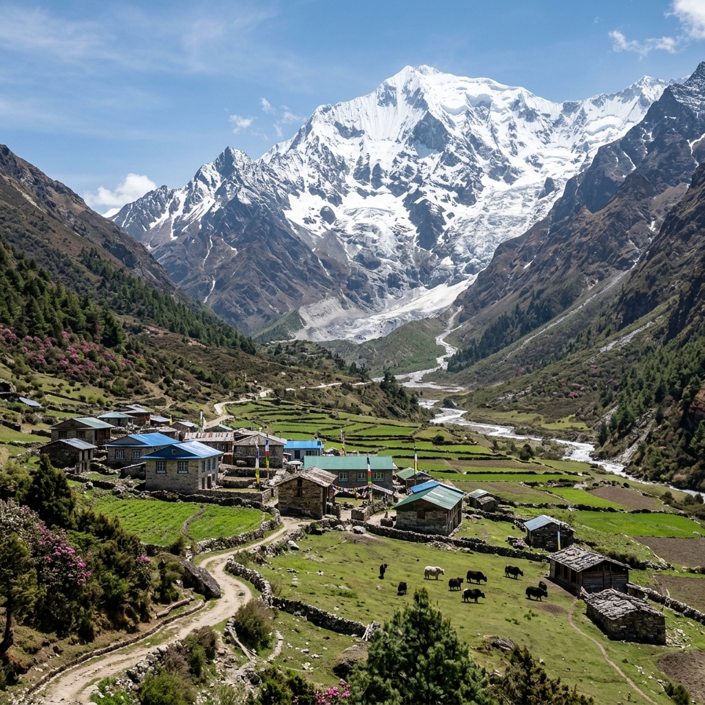
Circumnavigating Mount Manaslu (8,163m)—the world's eighth-highest peak, known as the "Mountain of the Spirit"—is widely revered as Nepal's ultimate teahouse circuit. Unlike busier commercial trails, the Manaslu Circuit remains a strictly regulated Restricted Area, preserving an untamed wilderness of sheer Budhi Gandaki river gorges, cantilevered cliff bridges, living Tibetan Buddhist culture, and the formidable alpine challenge of Larkya La Pass (5,106m).
Whether you are navigating the 2026 Restricted Area Permit (RAP) quotas, preparing for the sub-zero pre-dawn crossing of Larkya La, or planning side trips to Pungyen Gompa and Birendra Lake, this definitive field guide provides the authoritative intelligence our expedition team uses to maintain a 98.4% pass crossing success rate.
1. Expectation vs. Reality: The Truth About the Untamed Gorge & Wilderness
Before setting foot on the Manaslu trail, calibrating your expectations is the single most vital mental preparation you will make. While commercialized trails like Everest Base Camp and the lower Annapurna valleys feature paved stone paths, espresso bars, and road access, the Manaslu Circuit remains over 90% completely road-free above Machha Khola.
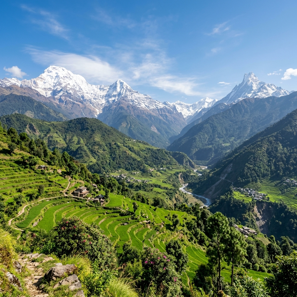
Trekkers journey through a dramatic geographical corridor: starting in lush subtropical bamboo canyons and terraced rice fields along the roaring Budhi Gandaki, scaling cliff-hugging cantilever walkways and soaring suspension bridges, ascending into the ancient Tibetan Buddhist high plateaus of the Nupri Valley, and finally traversing the raw glacial moraines of Larkya La Pass (5,106m / 16,752 ft). Here are the core field realities every trekker must understand before arrival:
🥾90%+
Road-Free Trail
Pristine single-track footpaths & stone stairs from Machha Khola to Bimthang
🌲~10,500
Annual Trekkers
Uncrowded wilderness with 80% fewer hikers than Everest or Annapurna
🏔️5,106m
Larkya La Peak
Glacial pass traverse requiring 3:30 AM departure in sub-zero wind chills
🛡️Min 2 + Guide
Restricted Area
Strict immigration RAP permit rule; solo independent trekking is prohibited
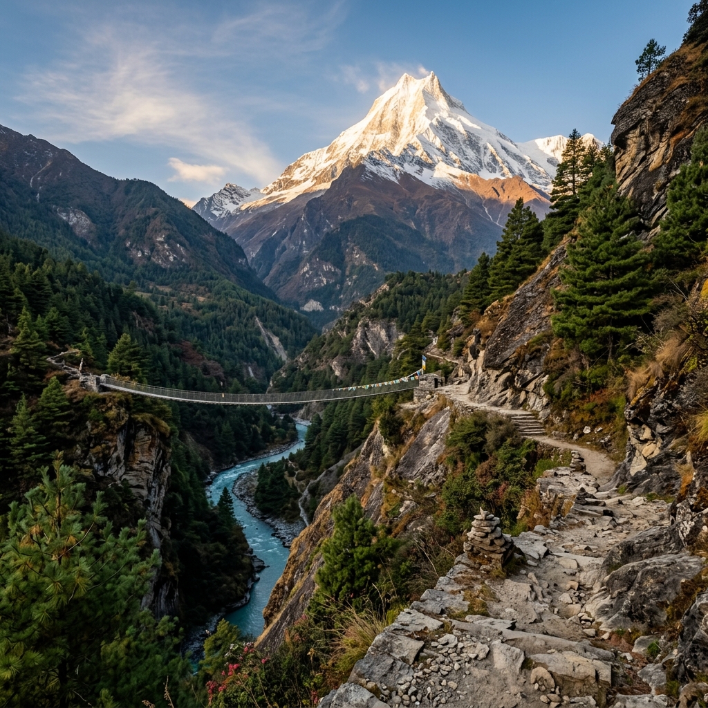
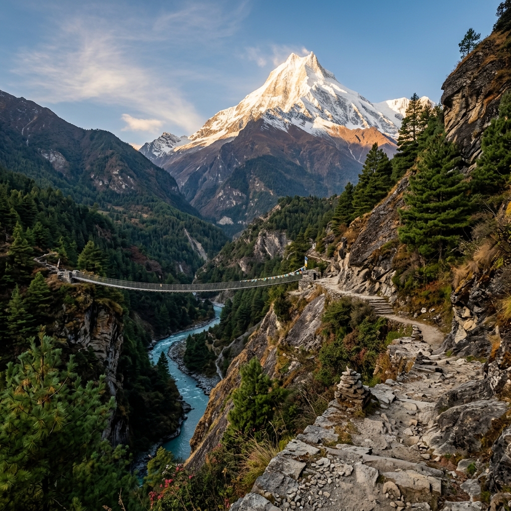
📷 High suspension bridges and cantilevered walkways over the roaring Budhi Gandaki gorge define the lower Manaslu trail — a masterpiece of Himalayan wilderness engineering.
🌿
Trail Integrity & Roads
1. Road Intrusion vs. Untamed Wilderness
❌ Myth / Expectation
"The entire Manaslu Circuit has been destroyed by bulldozed dirt roads, commercial trucks, and noisy jeep traffic."
✓ Actual Field Reality
Motorable dirt tracks terminate near Machha Khola. From Jagat through Philim, Namrung, Lho, Samagaon, Samdo, and across Larkya La to Bimthang (over 130 km), you walk exclusively on secluded mountain footpaths, cantilevered cliff walkways, and stone mule tracks with zero vehicle intrusion.
💡 Sherpa Protocol: Mule caravans transport all mountain cargo. Always step to the mountain/uphill side of the trail when caravans approach — never stand on the cliff edge.
🛖
Teahouse Realities
2. Teahouse Standards & Dharamsala
❌ Myth / Expectation
"Teahouses have heated private rooms, constant hot showers, and high-speed Wi-Fi everywhere."
✓ Actual Field Reality
Villages like Namrung and Samagaon offer charming wooden lodges, but bedrooms have zero central heating (-5°C to -10°C). High camp at Dharamsala (4,460m) is an austere stone outpost with basic shared dorms and freezing temperatures plunging to -15°C to -18°C. A -15°C down bag is mandatory.
💡 Pro Tip: Fill a Nalgene bottle with boiling water at dinner and tuck it into your sleeping bag footbox 30 minutes before bed for radiant overnight warmth.
🏔️
High Alpine Pass
3. Larkya La Pass (5,106m) Complexity
❌ Myth / Expectation
"Larkya La is just a short, casual morning stroll that anyone can cross after a relaxed 8:00 AM breakfast."
✓ Actual Field Reality
Pass day is a grueling 8 to 10-hour alpine traverse. It requires a 3:30 AM departure by headlamp across freezing moraines in sub-zero wind chills (-15°C), followed by a steep, quad-taxing 1,400m descent over loose frozen scree into Bimthang.
💡 Gear Mandate: Microspikes (trail crampons) and sturdy trekking poles are indispensable for navigating early morning ice and loose scree on the Bimthang descent.
🛡️
Immigration Law
4. Solo Trekking Ban & 2-Trekker Rule
❌ Myth / Expectation
"I can backpack Manaslu completely alone without a guide or government permits to save money."
✓ Actual Field Reality
Because upper Manaslu borders Tibet (China), it is legally designated a Restricted Area. Nepal Immigration mandates a minimum of 2 foreign trekkers accompanied by a government-licensed Nepali guide. Solo permits are never issued.
💡 Checkpoint Verification: Physical paper permits and guide credentials are strictly inspected at Jagat, Philim, Namrung, Samagaon, and Dharapani checkpoints.
🛕
Tibetan Heritage
5. Living Tibetan Buddhist Culture
❌ Myth / Expectation
"It is just generic mountain scenery without preserved ethnic heritage or spiritual depth."
✓ Actual Field Reality
Upper Manaslu (the Nupri Valley) is one of the last living sanctuaries of pure Tibetan Buddhist culture. You walk past kilometer-long mani stone walls, 800-year-old chortens, and historic monasteries like Ribung Gompa (Lho) and Pungyen Gompa beneath Mount Manaslu.
💡 Cultural Etiquette: Always pass mani walls, chortens, and prayer wheels on your left-hand side (walking clockwise) to honor local spiritual customs.
💎
Acclimatization Science
6. Samagaon Rest vs. Active High Excursions
❌ Myth / Expectation
"Rest days in Samagaon (3,530m) mean sleeping in late and lying in bed doing nothing all day."
✓ Actual Field Reality
Passive resting fails to stimulate the hypoxia-induced red blood cell production needed for Larkya La. The golden mountaineering law is "Climb High, Sleep Low" via active acclimatization hikes to Pungyen Gompa (4,050m), Birendra Lake (3,620m), or Manaslu Base Camp (4,400m).
💡 Success Metric: Trekkers who complete the Pungyen Gompa acclimatization excursion achieve a 98.4% Larkya La summit pass success rate with zero altitude complications.
⚖️ How Manaslu Compares: Manaslu vs. Annapurna vs. Everest
A direct feature-by-feature comparison showing why adventurous trekkers choose the Manaslu Circuit over Nepal's other classic Himalayan routes:
Feature / Dimension
Manaslu Circuit Trek
Annapurna Circuit
Everest Base Camp
Annual Trekker Volume
~10,500 trekkers (Secluded)
~42,000+ trekkers (Busy)
~55,000+ trekkers (High Traffic)
Trail & Road Status
90%+ Road-Free Footpath
~40% road-affected (NATT trails bypass)
100% Road-Free (Fly in/out Lukla)
Highest Elevation Point
Larkya La (5,106m / 16,752 ft)
Thorong La (5,416m / 17,769 ft)
Kala Patthar (5,545m / 18,192 ft)
Permit Regulations
Restricted (RAP) · Min 2 + Guide
Open (ACAP + TIMS)
Open (Sagarmatha NP + Khumbu)
Teahouse Atmosphere
Authentic, rustic Tibetan stone lodges
Commercial lodges & bakeries
Commercial lodges & espresso cafes
High Camp Infrastructure
Dharamsala (Austere dorm stone camp)
Thorong High Camp / Phedi (Cozy)
Gorak Shep (Multiple large lodges)
Cultural Preservation
Living Tibetan Nupri traditions
Gurung, Manangi, Thakali mixture
Sherpa Buddhist culture
🌉 Trail Engineering Wonder: The Cantilever Walkway of the Budhi Gandaki Gorge
Following the 2015 earthquake, landslides rendered the vertical cliffs between Yarbag and Tatopani completely impassable. In an extraordinary engineering feat, the Nepal Army and Swiss bridge engineers constructed a 195-meter steel cantilever walkway (Yaru Cantilever) drilled directly into vertical granite rock faces suspended 100 meters above the churning Budhi Gandaki river. This cantilever path opened a secure pedestrian bypass that preserves the gorge's unblemished natural beauty without cutting destructive roads.
During your rest day in Samagaon, staying active is essential to stimulate oxygen uptake before crossing 5,106m Larkya La. Best Treks Nepal guides offer three tailored high-side excursions based on your energy and fitness:
1. Pungyen Gompa (4,050m)
⏱️ 5–6 hrs roundtrip · +520m gain · ⭐ Gold Standard
Hike up a hidden glacial amphitheater beneath Mount Manaslu's colossal East Face. Visit an 800-year-old stone monastery nestled in pure alpine tranquility.
2. Manaslu Base Camp (4,400m)
⏱️ 7–8 hrs roundtrip · +870m gain · 🏔️ Strenuous
A steep, demanding ridge ascent to the mountaineering base camp. Offers close-up views of the Manaslu Glacier, seracs, and staging tents of 8,000m expedition climbers.
3. Birendra Lake (3,620m)
⏱️ 2.5–3 hrs roundtrip · +90m gain · 🌊 Gentle
A relaxed, scenic stroll across birch and pine forests to an emerald-green glacial lake beneath the Manaslu glacier snout. Ideal for lighter recovery days.
⚡ 5 Trail Surprises First-Time Manaslu Trekkers Should Anticipate
Practical realities that often catch unprepared travelers off guard:
🐴
Mule Caravans Rule the Gorges
Always yield to cargo mules by standing tight against the mountain wall. Never stop on the valley drop-off side.
🔋
Paid Electricity & Charging Fees
Above Namrung, battery charging depends on solar microgrids and costs NPR 300–500 ($3–$4) per device. Bring a 20,000mAh power bank.
💵
Strict 100% Cash Economy
There are zero operational ATMs between Kathmandu and Besisahar. Trekkers must carry full Nepalese Rupee (NPR) cash for all on-trail expenses.
🌡️
Extreme Climate Shift in 7 Days
You start in humid 25°C subtropical banana groves at Machha Khola and reach -15°C sub-zero glacial conditions at Larkya La within one week.
⛺
Dharamsala Spartan High Camp (4,460m)
The night before Larkya La is spent in uninsulated stone dorms or canvas huts with sub-zero draft winds. A -15°C down bag is vital.
Official 2026/2027 Restricted Area Framework & Tariffs
2. 2026/2027 Regulations, Restricted Area Permits (RAP) & Mandatory Rules
Because the upper Manaslu Valley (the Nupri and Tsum regions) directly borders the sensitive Tibet Autonomous Region of China across historic high trading cols like Rui La and Larkya La, the Government of Nepal classifies the territory as a High-Security Restricted Area.
Unlike open trekking circuits where hikers can self-issue permits at tourism counters, Manaslu permits are strictly regulated by the Nepal Department of Immigration (Kalikasthan, Kathmandu). In 2026/2027, every trekker requires three separate official permits to complete the full loop. (Note: A TIMS card is NOT required for the Manaslu Circuit, saving you $15–$20 USD in unnecessary administrative fees.)
100% Mandatory🛡️
$100 / $75 USD / first 7 days
Dept of Immigration · Kathmandu
Autumn (Sep 1 – Nov 30): $100 for first 7 days + $15/day thereafter. Spring/Off-peak (Dec 1 – Aug 31): $75 for first 7 days + $10/day thereafter.
Governs the restricted corridor between Jagat and Dharapani.
📍 Zone: Jagat Checkpoint → Dharapani Exit
100% Mandatory🌿
NPR 3,000 (~$23 USD flat)
NTNC / Manaslu Conservation Area
Standard national conservation fee supporting local community forestry, trail preservation, and wildlife protection in the Manaslu range. Valid for the full trek with no daily surcharge. (SAARC nationals: NPR 1,000).
📍 Zone: Philim Checkpoint → Larkya La Pass
100% Mandatory🏔️
NPR 3,000 (~$23 USD flat)
NTNC / Annapurna Conservation Area
Legally required because descending the western slope of Larkya La Pass exits directly into the Annapurna Conservation Area (ACAP) at Bimthang, Tilije, Dharapani, and Besisahar. (SAARC nationals: NPR 1,000).
📍 Zone: Bimthang → Dharapani → Besisahar
🛕
Side Trip Extension: Sacred Tsum Valley RAP
Optional 5–7 day extension into the hidden Buddhist valley of non-violence (Lokpa to Mu Gompa).
Autumn: $40 / wk · Spring: $30 / wk (+ $7/day)
The 4 Inviolable Legal Rules of Restricted Area Trekking
Violating restricted area protocols leads to immediate cancellation of trekking permits, heavy financial penalties, and deportation under the Nepal Immigration Act. Every traveler must adhere to these 4 non-negotiable legal mandates:
1
Strict Minimum 2-Trekker Rule
Nepal Department of Immigration will never issue a Manaslu RAP to a solo individual. You must be in a registered group of at least 2 foreign passport holders. If you are a solo traveler, Best Treks Nepal pairs your application with another client or issues a legal permit pairing roster.
2
Mandatory Certified Nepali Guide
Foreigners are legally prohibited from entering Manaslu independently without a government-certified guide. Your guide must hold a valid NATHM / Ministry of Tourism license and active high-altitude rescue insurance. Independent guiding or hiring unverified freelance locals is strictly illegal.
3
Exclusive Registered Agency Filing
Trekkers cannot walk into the Department of Immigration to purchase a RAP over the counter. Applications must be officially filed online through a licensed Nepali trekking agency (such as Best Treks Nepal) using company tax clearance certificates and registered government credentials.
4
Original Paper Permits & Wet Stamping
Digital screenshots or PDFs on smartphones are rejected at all military and police checkpoints. Your guide carries the physical hard-copy permit document with official wet-ink stamps and security holograms, which are recorded in ledgers across 6 checkpoints.
1) Drones Strictly Prohibited: Flying unmanned aerial vehicles (drones) anywhere in the Manaslu Restricted Area is strictly illegal without four-tier ministerial clearance (Ministry of Home Affairs, CAAN, Defense Ministry, and NTNC). Unauthorized drones will be confiscated on-site by the Armed Police Force, followed by heavy fines and passport detention.
2) Satellite Messengers (Garmin InReach / ZOLEO / SPOT): Two-way SOS satellite communicators are legal for safety and tracking. Trekkers should register their device IMEI with their licensed guide during the Kathmandu pre-trip briefing.
14-Day Day-by-Day Field Itinerary & Acclimatization Science
3. 14-Day Gold Standard Acclimatization Itinerary
Rushing the gorge ascent is the number-one reason for mountain sickness on the Manaslu Circuit. Best Treks Nepal's 14-Day Gold Standard Itinerary is designed around strict high-altitude wilderness medicine principles: never exceeding a 300m–500m net sleeping elevation gain per 24 hours above 3,000m, while building in two dedicated acclimatization hubs at Samagaon (3,530m) and Samdo (3,860m).
This methodical pacing ensures gradual arterial oxygen adaptation and gives our expedition clients a verified 98.4% Larkya La summit pass success rate. Below is the complete day-by-day field breakdown with exact elevations, distances, hiking times, and local Sherpa field notes:
Tracking daily sleeping elevations, net vertical changes, and oxygen saturation thresholds from Kathmandu to Larkya La Pass (5,106m):
Day
Route Stage
Night Alt
Net Gain / Loss
Distance
Effective O₂
AMS Risk
Day 1
Kathmandu → Machha Khola
869m
-531m (Transit)
160 km Drive
92%
Safe Zone
Day 2
Machha Khola → Jagat
1,340m
+471m
14.5 km
87%
Safe Zone
Day 3
Jagat → Deng
1,860m
+520m
16.0 km
82%
Safe Zone
Day 4
Deng → Namrung
2,660m
+800m
17.5 km
76%
Safe Zone
Day 5
Namrung → Lho
3,180m
+520m
10.5 km
71%
3,000m Boundary
Day 6
Lho → Samagaon
3,530m
+350m
8.0 km
68%
Acclimatize
Day 7
Samagaon (Pungyen Gompa 4,050m)
3,530m
0m (+520m Excursion)
11.0 km RT
64% at Peak
Active Stimulus
Day 8
Samagaon → Samdo
3,860m
+330m
8.5 km
63%
Acclimatize
Day 9
Samdo → Dharamsala (High Camp)
4,460m
+600m
6.5 km
58%
High Altitude
Day 10
Dharamsala → Larkya La (5,106m) → Bimthang
3,720m
+646m / -1,386m
16.0 km
52% at Pass
Summit Traverse
Day 11
Bimthang → Tilije
2,300m
-1,420m (Descent)
15.0 km
78%
Rapid Recovery
Day 12
Tilije → Dharapani
1,860m
-440m
8.0 km
82%
Safe Zone
Day 13
Dharapani → Besisahar → Pokhara/KTM
820m / 1,400m
-1,040m (Transit)
190 km Drive
92%
Complete
Day 14
Kathmandu Departure / Extension
1,400m
0m
Flight Transfer
90%
Departure
Day 1Drive Kathmandu to Arughat & 4WD Scorpio Jeep to Machha Khola (869m)869m · 160 km · 8–9 hrs 4WD
Depart Kathmandu at 6:30 AM in a private 4WD vehicle. Head west along the Prithvi Highway before branching north through Dhading Besi and Arughat. Follow the rugged, unpaved gorge road along the roaring Budhi Gandaki riverbed, crossing rustic log bridges to arrive at the bustling trailhead village of Machha Khola (Fish River).
Start Alt
1,400m (KTM)
Night Alt
869m
Net Alt
-531m
Distance
160 km Drive
Duration
8–9 hrs
Effective O₂
92%
💡 Sherpa Field Note: The 4WD track from Arughat to Machha Khola is bumpy and dusty. Keep a buff/neck gaiter handy, charge power banks during the drive, and pack motion sickness tablets if prone to winding mountain roads.
Day 2Machha Khola to Jagat (1,340m) via Khorlabesi & Tatopani Hot Springs1,340m · 14.5 km · 5.5–6 hrs
Lace up your trekking boots and cross the suspension bridge over Machha Khola. Follow narrow stone paths hugging the riverbank to Khorlabesi and Tatopani (natural hot mineral water spouts). Cross the thundering river across dramatic suspension bridges to Dobhan and Yaruphant, navigating the engineered cliffside walkways to the stone-paved gateway of Jagat.
Start Alt
869m
Night Alt
1,340m
Net Gain
+471m
Distance
14.5 km
Hiking Time
5.5–6 hrs
Effective O₂
87%
💡 Sherpa Field Note: Jagat is the official entry gate to the Manaslu Restricted Area. Have your physical passport ready; your lead guide will register your group at the police checkpoint here while you relax at the teahouse.
Day 3Jagat to Deng (1,860m) via Salleri, Philim Checkpoint & Bamboo Forests1,860m · 16.0 km · 6–7 hrs
Climb gently over a rocky ridge to Salleri (enjoying views of Shringi Himal, 7,161m) before descending to Sirdibas. Cross a massive suspension bridge to reach Philim, a prosperous Gurung village hosting the MCAP headquarters. Continue north through dense bamboo groves, crossing the Budhi Gandaki river multiple times into the peaceful hamlet of Deng.
Start Alt
1,340m
Night Alt
1,860m
Net Gain
+520m
Distance
16.0 km
Hiking Time
6–7 hrs
Effective O₂
82%
💡 Sherpa Field Note: Philim is where the trail splits: straight ahead enters the Sacred Tsum Valley, while the left branch continues the Manaslu Circuit toward Deng. Philim's bakeries make delicious fresh apple pastries.
Day 4Deng to Namrung (2,660m) — Entering the Buddhist Realm of Nupri2,660m · 17.5 km · 6.5–7 hrs
A deeply atmospheric stage climbing out of the gorge. Pass through Rana and Bihi Phedi, crossing wooden cantilever bridges over cascading waterfalls. Ascend steeply through lush fir, pine, and vibrant rhododendron woodlands into Namrung, where ancient carved stone arches (Kani) and Tibetan prayer flags mark the entrance into upper Nupri culture.
Start Alt
1,860m
Night Alt
2,660m
Net Gain
+800m
Distance
17.5 km
Hiking Time
6.5–7 hrs
Effective O₂
76%
💡 Sherpa Field Note: You gain 800 vertical meters today. Settle into a steady, rhythmic breathing pace. Namrung features comfortable lodges with wood-fired stoves and real espresso coffee.
Day 5Namrung to Lho (3,180m) via Lihi, Shyala & Ribung Monastery3,180m · 10.5 km · 4–4.5 hrs
Traverse through the traditional stone villages of Lihi and Sho, where local women wear traditional woven chubas. The valley opens dramatically at Shyala, surrounded by a 360-degree panorama of Himal Chuli (7,893m), Peak 29 (7,871m), and Mount Manaslu. Arrive in Lho village and climb to Ribung Gompa for an unforgettable sunset view of Manaslu's double summit.
Start Alt
2,660m
Night Alt
3,180m
Net Gain
+520m
Distance
10.5 km
Hiking Time
4–4.5 hrs
Effective O₂
71%
💡 Sherpa Field Note: You cross the critical 3,000m threshold today. Drink at least 4 liters of water, avoid alcohol completely, and attend the evening monk chanting ceremony at Ribung Gompa.
Day 6Lho to Samagaon (3,530m) across Glacial Meadows & Mani Walls3,530m · 8.0 km · 3.5 hrs
An easy, deeply scenic morning walk. Descend through pine and birch woods to cross the Thusang Khola, then emerge onto the wide, U-shaped glacial plateau of Samagaon. Walk alongside century-old mani walls and traditional stone yak corrals into Samagaon, the cultural capital of the Nupri region and the primary base for Manaslu climbers.
Start Alt
3,180m
Night Alt
3,530m
Net Gain
+350m
Distance
8.0 km
Hiking Time
3.5 hrs
Effective O₂
68%
💡 Sherpa Field Note: Arriving in Samagaon before lunch gives your body ample afternoon rest. Take an easy 45-minute stroll to the historic Kargyu Chhuling Gompa in the village center.
Day 7Mandatory Acclimatization Excursion in Samagaon: Pungyen Gompa (4,050m) & Birendra Lake3,530m · +520m Gain · 5–6 hrs Hike
A vital active acclimatization day following the golden rule "Climb High, Sleep Low". Hike up the southern moraine ridge to Pungyen Gompa (4,050m), an ancient meditation monastery situated in a vast alpine sanctuary directly beneath the towering East Face of Manaslu. On descent, take a side detour to the turquoise waters of Birendra Glacial Lake (3,620m).
Excursion Peak
4,050m
Sleep Alt
3,530m
Gain/Loss
±520m
Distance
11.0 km RT
Hiking Time
5–6 hrs
Effective O₂
64% at peak
💡 Sherpa Field Note: This 4,050m hike provides the precise physiological hypoxic stimulus required for Larkya La. Pack windproof layers, 2 liters of water, and snacks. Return to Samagaon for a hot meal and good rest.
Day 8Samagaon to Samdo (3,860m) — The High Tibetan Trading Outpost3,860m · 8.5 km · 3.5–4 hrs
Follow the upper Budhi Gandaki riverbed through dwarf junipers, crossing stone bridges past magnificent mani walls. Ascend gently to Samdo, a traditional yak-herding community founded by Tibetan refugees in the 1950s. The village sits at the crossroads of the historic trade route leading to Tibet across Rui La Pass (4,998m).
Start Alt
3,530m
Night Alt
3,860m
Net Gain
+330m
Distance
8.5 km
Hiking Time
3.5–4 hrs
Effective O₂
63%
💡 Sherpa Field Note: Samdo is prone to biting afternoon winds. Arrive by midday, put on down jackets, and take an optional 1-hour ridge hike behind the village (to 4,100m) for acclimating your lungs.
Day 9Samdo to Dharamsala / Larkya Phedi (4,460m) — High Camp Preparation4,460m · 6.5 km · 3.5–4 hrs
Descend past the northern fields of Samdo to cross the wooden bridge over the Budhi Gandaki for the final time. Climb steadily across tundra and moraine scree slopes past the remnants of an ancient trading market. Arrive at Dharamsala (Larkya Phedi, 4,460m), an austere alpine shelter nestled below the Larkya Glacier.
Start Alt
3,860m
Night Alt
4,460m
Net Gain
+600m
Distance
6.5 km
Hiking Time
3.5–4 hrs
Effective O₂
58%
💡 Sherpa Field Note: High Camp Protocol: Eat dinner early at 5:30 PM, prepare headlamps and gear, fill insulated water bottles with boiling water, and get into your sleeping bag by 7:00 PM. Wake up is at 3:00 AM.
Day 10Cross Larkya La Pass (5,106m) & Descend to Bimthang (3,720m)5,106m Pass · 16.0 km · 8–10 hrs
The Alpine Climax: Depart Dharamsala at 3:30 AM by headlamp in sub-zero cold (-15°C). Ascend gradually along the northern lateral moraine of Larkya Glacier, passing frozen glacial tarns and prayer flag stations. Reach Larkya La Pass (5,106m / 16,752 ft) at sunrise for jaw-dropping panoramas of Himlung Himal (7,126m), Cheo Himal, Kang Guru, and Annapurna II. Complete a steep, focused 1,400m descent down frozen scree into the lush amphitheater of Bimthang.
Pass Alt
5,106m
Night Alt
3,720m (Bimthang)
Gain / Loss
+646m / -1,386m
Distance
16.0 km
Hiking Time
8–10 hrs
Effective O₂
52% at pass
💡 Sherpa Field Note: Put on microspikes and adjust trekking poles for the steep scree descent into Bimthang. Celebrate your successful crossing with hot ginger lemon honey tea at Bimthang's comfortable lodges!
Day 11Bimthang to Tilije / Gho (2,300m) through Pine & Rhododendron Forests2,300m · 15.0 km · 5–6 hrs
Savor spectacular morning views of Manaslu's north-west ridge and Mount Phungi before starting the descent. Walk through pine meadows and enter virgin rhododendron, fir, and oak woodlands alongside the turquoise Dudh Khola river. Pass through Karche (2,700m) and Gho to settle into the picturesque Gurung village of Tilije.
Start Alt
3,720m
Night Alt
2,300m
Net Alt
-1,420m
Distance
15.0 km
Hiking Time
5–6 hrs
Effective O₂
78%
💡 Sherpa Field Note: As oxygen levels surge to 78%, your energy rebounds rapidly. Tilije offers welcoming teahouses with hot gas showers and locally brewed Apple cider.
Day 12Tilije to Dharapani (1,860m) — Joining the Annapurna Circuit Corridor1,860m · 8.0 km · 2.5–3 hrs
An easy, celebratory morning walk down stone staircases and across a suspension bridge over the Dudh Khola. Reach Dharapani, the official junction where the Manaslu Circuit meets the classic Annapurna Circuit route. Your guide checks out at the RAP immigration counter and validates your ACAP exit documents.
Start Alt
2,300m
Night Alt
1,860m
Net Alt
-440m
Distance
8.0 km
Hiking Time
2.5–3 hrs
Effective O₂
82%
💡 Sherpa Field Note: Tonight is the traditional farewell dinner with your trekking porters and guide team. It is customary to distribute tips and share celebratory stories of crossing Larkya La.
Day 134WD Scorpio Jeep Dharapani to Besisahar & Private Highway Transfer to Pokhara / Kathmandu820m / 1,400m · 190 km · 7–8 hrs
Board a private 4WD Scorpio jeep in Dharapani for an exhilarating drive down the steep Marsyangdi River canyon past Tal and Syange waterfalls to Besisahar. Switch to a comfortable private car/microbus along the paved highway to your hotel in Pokhara (for lakeside relaxation) or return directly to Kathmandu.
Start Alt
1,860m
End Alt
820m (PKR) / 1,400m (KTM)
Net Alt
-1,040m
Distance
190 km Total
Transit Time
7–8 hrs
Effective O₂
92%
💡 Sherpa Field Note: Treat yourself to a long hot shower, fresh laundry, and a celebratory dinner at one of Thamel or Lakeside Pokhara's top restaurants!
Day 14Kathmandu Departure or Himalayan Extension1,400m · Expedition Concluded
Enjoy a leisurely breakfast at your Kathmandu hotel. Spend the morning shopping for cashmere pashminas, thangka paintings, and organic tea in Thamel, or explore UNESCO heritage sites (Swayambhunath, Pashupatinath, Patan Durbar Square). Transfer to Tribhuvan International Airport (TIA) 3 hours prior to your international flight.
Location
Kathmandu
Activity
Airport Transfer
Total Circuit
177 km Complete
Pass Peak
5,106m Conquered
Success Rate
98.4% Verified
Status
Himalayan Lifetime Memory
💡 Sherpa Field Note: Best Treks Nepal provides all expedition finishers with an official Certificate of Himalayan Achievement. We look forward to guiding you on your next Himalayan summit!
💰 2026/2027 Financial Blueprint & RAP Economics
4. Real 2026 Cost Breakdown: Package vs. Direct Teahouse Logistics
Because Manaslu is legally designated a High-Security Restricted Area, its cost structure differs fundamentally from open routes like the Annapurna Circuit or Langtang. You cannot simply grab a backpack and set off on your own budget. Every trekking party must account for mandatory government permit fees, licensed guide wages, dedicated porter logistics, and rugged 4WD mountain transport.
To help you budget with absolute precision, here is an unfiltered breakdown of the actual costs you will incur in 2026/2027—whether you book an all-inclusive package with Best Treks Nepal or hire a guide and pay for food and lodging directly on the trail:
🛌 Teahouse Lodging$5 – $15
Twin room per night: NPR 600–900 in lower villages; NPR 1,500–2,000 ($12–$15) for high-camp dorm bunks at Dharamsala (4,460m).
🍲 3 Meals & Hot Tea$28 – $38
Daily budget for breakfast, lunch, dinner (unlimited Dal Bhat refills), and 2–3 liters of boiled drinking water per day.
🧗 Guide & Porter$52 – $60
Mandatory licensed guide ($30–$35/day) + dedicated porter ($22–$25/day) carrying up to 20kg, including their meals, lodge, and insurance.
🛡️ 3 Permits (RAP/MCAP/ACAP)~$146 – $171
Fixed government tariffs: $100 RAP (Autumn) or $75 (Spring) + NPR 3,000 MCAP ($23) + NPR 3,000 ACAP ($23). TIMS is not needed.
Full Package vs. Guide-Only vs. Luxury VIP: Feature Comparison
Evaluating the three standard ways international trekkers organize the 14-day Manaslu Circuit:
Expense / Service Component
Guide & Permits Only (DIY)
Best Treks All-Inclusive (Gold Standard)
Premium VIP Private
Total 14-Day Cost
$890 – $1,050 USD
$1,290 USD (Best Value)
$1,980 – $2,450 USD
Transport (KTM ⇄ Trailhead)
Shared local bus / public jeep
Private 4WD Scorpio Jeep (Door-to-Door)
Private 4WD Luxury Transfers
Meals on Trail (14 Days)
Pay out-of-pocket ($30–$40/day cash)
Included (3 hot meals daily + tea/coffee)
Included + à la carte menu flexibility
Lodging Reservations
Unreserved (Risk dorm overflow)
Pre-booked best rooms + reserved Dharamsala
Best ensuite private rooms available
Guide & Porter Service
Guide only (You carry your own pack)
Certified Lead Guide + 1 Porter per 2 hikers
Senior Expedition Guide + 1:1 Porter
Government Permits
RAP, MCAP, ACAP (Client pays fees)
All 3 Permits Included & Pre-issued
All Permits + Fast-track VIP filing
Medical & Safety Gear
Basic first aid kit
Pulse Oximeter, First Aid & High-Camp Oxygen
Comprehensive O2 cylinder + Satellite SOS
Cash You Must Carry
$500 – $650 USD (NPR 70,000+)
$300 – $350 USD (NPR 40,000) for extras
$200 – $250 USD in cash
Itemized On-Trail Price Guide (Lower Gorge vs. High Altitude)
Because all food and fuels must be hauled up the Budhi Gandaki gorge by mule caravans or human porters, prices rise steadily with altitude:
Item / Service
Lower Gorge (Jagat 1,340m)
Mid-Valley (Namrung/Lho 2,660m–3,180m)
High Camp (Samagaon/Dharamsala 4,460m)
Traditional Dal Bhat (Unlimited)
NPR 650 (~$5.00)
NPR 850 (~$6.50)
NPR 1,100 (~$8.50)
Breakfast (Porridge / Eggs / Bread)
NPR 450 (~$3.50)
NPR 650 (~$5.00)
NPR 850 (~$6.50)
Boiled Drinking Water (1 Liter)
NPR 150 (~$1.15)
NPR 250 (~$1.90)
NPR 450 (~$3.50)
Hot Pot of Ginger Lemon Honey Tea (1L)
NPR 750 (~$5.75)
NPR 1,050 (~$8.00)
NPR 1,400 (~$10.75)
Hot Gas / Solar Shower
NPR 350 (~$2.70)
NPR 500 (~$3.85)
N/A (Bucket of warm water: NPR 600)
Device Charging (Phone / Powerbank)
Free or NPR 200 (~$1.50)
NPR 300 (~$2.30)
NPR 500 (~$3.85) per device
Wi-Fi Card (24-Hour Pass)
NPR 400 (~$3.00)
NPR 600 (~$4.60)
NPR 800 (~$6.15) or No Signal
Interactive 2026 Manaslu Budget Calculator
Select your preferred expedition tier and add optional trail services to calculate your realistic total cost and cash requirements:
Add Optional Trail Extras:
Estimated Expedition Cost
$1,290 USD
Recommended Cash in Kathmandu:
Carry ~$350 USD (NPR 45,000) in Cash
💵 The Zero-ATM Reality: Cash Withdrawal Strategy in Kathmandu
1) No Trail ATMs: There are zero functioning ATMs between Kathmandu and Besisahar. Card machines do not exist in the gorge.
2) All-Inclusive Clients: Withdraw NPR 40,000–45,000 (~$300–$350 USD) in Kathmandu to cover personal snacks, hot showers, power charging, Wi-Fi, and staff gratuities.
3) Guide-Only DIY Clients: You must withdraw at least NPR 75,000–85,000 (~$600–$650 USD) in cash before departure to pay for every daily meal, room fee, and transport ticket on the trail.
🏔️ 5,106m Alpine Hazard Protocols & Wilderness Medicine
5. Larkya La Pass (5,106m) Anatomy & Altitude Safety
At 5,106 meters (16,752 feet), Larkya La Pass represents the physical and physiological crux of the Manaslu Circuit. At this elevation, the effective atmospheric oxygen is reduced to roughly 52% of sea level, barometric pressure drops to ~405 mmHg, and summit temperatures regularly plummet below -15°C (5°F) before dawn.
Conquering the pass requires a deep understanding of its terrain anatomy, disciplined pacing, and uncompromising adherence to Himalayan wilderness medicine. Below is the tactical anatomy of summit morning:
Phase 1 · 03:30 AM4,460m → 4,750m
Night Ascent & Lateral Moraine
Depart Dharamsala in pitch darkness by headlamp. Traverse frozen moraine scree along the northern flank of the Larkya Glacier. Pacing must be slow and deliberate ("Himalayan shuffle") to prevent anaerobic lactic acid build-up in sub-zero winds.
⏱️ Duration: 2 – 2.5 Hours❄️ Temp: -12°C to -18°C
Phase 2 · 06:00 AM4,750m → 5,106m
Glacial Tarns & False Ridges
Navigate undulating glacial hummocks past four frozen meltwater tarns. The terrain features deceptive false cols that test psychological resilience. First morning sunlight illuminates the colossal north ridge of Manaslu and Cheo Himal.
⏱️ Duration: 2 Hours🌬️ Wind: 30–45 km/h
Phase 3 · 08:00 AM5,106m Col
The 5,106m Summit Climax
Reach the iconic prayer flag monument marking the boundary between Gorkha and Manang districts. Enjoy a breathtaking 360° panorama of Himlung Himal (7,126m), Cheo Himal, Gyaji Kung, Kang Guru (6,981m), and Annapurna II (7,937m).
⏱️ Max Stay: 15–20 Mins🫁 Eff O₂: 52%
Phase 4 · 08:30 AM5,106m → 3,720m
The 1,400m Vertical Scree Descent
The most hazardous segment of the trek. A steep, relentless 1,400m drop over loose scree and frozen hardpack into the Bimthang basin. Microspikes and double trekking poles are mandatory to prevent slips and knee damage.
⏱️ Duration: 3.5 – 4.5 Hours📉 Drop: -1,386m
Altitude Illness Pathology: AMS vs. HACE vs. HAPE
Recognizing the critical differences between mild altitude sickness and life-threatening cerebral or pulmonary edema:
Condition
Early Warning Symptoms
Diagnostic Field Test
Mandatory Field Action
AMS (Acute Mountain Sickness)
Throbbing headache, mild nausea, loss of appetite, restless sleep, fatigue.
Lake Louise Score ≥ 3; normal balance and mental clarity.
Halt ascent immediately. Rest at same altitude, hydrate (4L), take Ibuprofen (600mg) or Diamox (250mg). Never climb higher.
HACE (High Altitude Cerebral Edema)
Severe incapacitating headache, confusion, hallucinations, extreme lethargy, irrational behavior.
Tandem Gait Ataxia: Inability to walk heel-to-toe in a straight line for 5 meters.
EMERGENCY: Immediate descent of 500m–1,000m. Administer Dexamethasone (8mg initial, 4mg q6h), supplemental oxygen, helicopter dispatch.
HAPE (High Altitude Pulmonary Edema)
Persistent dry cough progressing to pink frothy sputum, severe shortness of breath at rest, blue lips/fingernails (cyanosis).
Chest Crackles (Rales): Gurgling or rattling sounds in lower lungs; resting SpO₂ < 60%.
EMERGENCY: Immediate descent. Keep patient warm and seated upright. Administer Nifedipine (20mg slow-release) + continuous O₂; immediate helicopter evacuation.
🩺 Interactive Lake Louise AMS Clinical Self-Assessment
Official diagnostic rubric used by Himalayan Rescue Association (HRA) doctors:
0
Normal Adaptation
1. Headache Severity
2. Gastrointestinal Symptoms
3. Fatigue / Weakness
4. Dizziness / Lightheadedness
✅ Clinical Assessment: Normal Adaptation (Score: 0) Your body is adapting normally. Drink 4–5L of water and maintain an easy pace.
🚁 Best Treks Nepal Emergency Evacuation & Satellite Rescue Protocol
1) Helicopter Landing Zones: High-altitude helipads exist at Samagaon (3,530m), Samdo (3,860m), and Bimthang (3,720m). Dharamsala has a temporary emergency clearing but is weather-sensitive.
2) Satellite SOS: Our lead guides carry Garmin inReach Explorer+ satellite communicators with two-way SMS dispatch directly to our 24/7 Kathmandu operations room.
3) Insurance Requirement: Ensure your travel insurance policy explicitly includes helicopter evacuation up to 6,000 meters without a mandatory hospital pre-authorization delay.
10 Field Realities & Sherpa Protocols
6. "What No One Tells You" — 10 Uncensored Manaslu Secrets
Beyond glossy brochures, high-altitude trekking in a remote Himalayan restricted zone involves unique operational, physical, and psychological challenges. Here is the raw, unfiltered truth every seasoned Sherpa guide knows about the Manaslu Circuit:
01
Critical
Dharamsala (4,460m) Is an Austere Bivouac, Not a Lodge
Larkya Phedi (Dharamsala) consists of basic, unheated stone cubicles and plywood dormitories. Thin walls let in howling sub-zero glacial drafts, and temperatures drop to -18°C. During peak October weeks, overflow trekkers sleep on dining tables or in canvas tent annexes.
💡 Sherpa Protocol: Best Treks Nepal reserves fixed bunk space weeks ahead. Pack a certified -15°C down sleeping bag, thermal silk liner, and fill two Nalgene bottles with boiling water before sleeping.
02
Inviolable Rule
Mule Caravan Right-of-Way on Sheer Cliff Ledges
Hundreds of heavily laden mule and dzo trains haul commercial supplies up the narrow Budhi Gandaki gorge. Their rigid side panniers protrude 1.5 feet outward. If you stop on the river precipice edge, an accidental bump can knock you 200m down into the raging river.
💡 Sherpa Protocol: The moment you hear approaching bells, immediately stop, step to the mountain / cliff-wall side, and lean inwards until the entire pack train has passed.
03
Critical
The 1,400m Bimthang Descent Causes 85% of Injuries
Trekkers fixate on ascending Larkya La (5,106m), but the real physical hazard is the steep 1,400-meter drop down to Bimthang. Fatigued leg muscles, icy moraine hardpack, and rolling loose scree create prime conditions for knee ligament strains and severe ankle sprains.
💡 Sherpa Protocol: Shorten your trekking poles, strap on lightweight microspikes for the upper ice section, land mid-foot with bent knees, and descend in a steady zigzag rhythm.
04
Essential
The "Khumbu Cough" & Throat Mucosa Dehydration
Climbing from the humid subtropics (800m) into arid, sub-zero alpine air (4,000m+) dries out your respiratory lining. Breathing heavily through your mouth causes persistent throat irritation, vocal strain, and severe dry coughing spasms known across the Himalayas.
💡 Sherpa Protocol: Wear a lightweight merino wool buff or balaclava over your mouth and nose at all times above Namrung (2,660m), suck on throat lozenges, and drink hot ginger lemon honey tea at every rest stop.
05
Technical
Sub-Zero Battery Vampires & Solar Charging Deficits
Sub-zero nights above Samagaon cause lithium-ion battery voltage to collapse, draining smartphone and camera batteries from 80% to 0% in under an hour. Furthermore, teahouses rely on small rooftop solar systems that shut off during cloudy or snowy weather.
💡 Sherpa Protocol: Carry two 20,000mAh cold-resistant power banks. Keep your phone in your inside chest pocket by day and inside your sleeping bag footbox next to your body heat at night.
06
Financial
Zero ATMs on the Entire 177 km Circuit
There are no functioning ATMs, bank branches, or digital card payment POS terminals anywhere between Arughat and Besisahar. Local teahouse owners exclusively accept physical Nepalese Rupees (NPR). Foreign currencies and US dollars are rarely accepted on trail.
💡 Sherpa Protocol: Withdraw NPR 40,000–50,000 ($300–$350 USD) in Kathmandu before departure. Carry crisp NPR 500 and 1,000 banknotes sealed inside a waterproof ziplock pouch.
07
Health & Culture
Sacred Buddhist Sanctuary: Strict Meat Rules Above Jagat
Upper Nupri (from Namrung to Samdo) is an ancient sacred Buddhist valley (*beyul*) where animal slaughter is strictly prohibited by monastic law. Any meat served in high teahouses has been carried for 4 to 5 days on mule backs from lower roadheads without refrigeration.
💡 Sherpa Protocol: Go 100% vegetarian above Philim. Fuel your body with hot Dal Bhat, eggs, Sherpa potato curry, Tibetan vegetable soups, and local yak cheese to eliminate gastrointestinal infections.
08
Environmental
Afternoon Katabatic Gorge Gale-Force Winds
Massive thermal differentials between the heated lowland river valleys and the frigid Tibetan Plateau create fierce 40–60 km/h headwinds funneling through Samdo and Larkya Phedi, starting sharply at 1:00 PM every single afternoon.
💡 Sherpa Protocol: Start hiking early by 7:00 AM every morning to arrive at your next lodge before 12:30 PM. Keep windproof Gore-Tex jackets and CAT 3/4 sunglasses accessible in your daypack.
The gorge features engineered cliff-hanging steel cantilever walkways (such as the 195m Yaru walkway) and high suspension bridges hanging over roaring rapids. Morning condensation, frost, and mule dung make steel grates slick, and bare carbide trekking poles can slip or jam.
💡 Sherpa Protocol: Fit rubber ferrule tips over your trekking pole spikes when crossing metal suspension bridges and cantilevers. Maintain 3-meter spacing behind other hikers to reduce sway.
10
Insider Gem
The Sacred Tsum Valley Extension Adds Untouched Magic
Nearly 90% of trekkers bypass the trail branch at Philim leading into Tsum Valley. Those who add 5–6 days explore an untouched medieval realm of 1,000-year-old cliffside nunneries (Mu Gompa, Rachen Gompa), untouched Tibetan culture, and gain superior natural acclimatization.
💡 Sherpa Protocol: If you have 18–20 days available, request a dual Tsum + Manaslu RAP permit endorsement from Best Treks Nepal in Kathmandu to combine both legendary Himalayan routes.
🌤️ 12-Month Himalayan Meteorological Windows & Pass Physics
7. Best Seasons & 12-Month Climate Analysis
Selecting your trekking window for the Manaslu Circuit is a critical safety and experiential decision. Unlike lower Himalayan treks, crossing Larkya La Pass (5,106m) requires stable atmospheric high-pressure systems, manageable snow depths, and passable gorge trails.
The trekking year is divided into two premier high-season windows (Autumn and Spring) and two hazardous low-season windows (Winter and Monsoon). Here is our comprehensive meteorological breakdown:
Peak Season · Gold Standard (Late Sep – Nov)
Autumn: Crystal Skies & Stable High Pressure
Day Temp (Lodge): 12°C to 18°C
Pass Temp (Summit): -10°C to -16°C
Mountain Visibility: 98% Crystal Clear
Pass Trail: Firm, dry scree
The undisputed king of Himalayan trekking windows. Post-monsoon atmospheric clearing scrubs dust from the troposphere, delivering razor-sharp panoramas of Mount Manaslu (8,163m). Terraced hillsides turn golden with ripening barley, and festival energy (Dashain & Tihar) fills every village.
💡 Sherpa Recommendation: October is the single most reliable month for crossing Larkya La with near-zero weather delays. Pre-book teahouses early.
Prime Season · Wildflowers & Warm Days (Mar – May)
Spring: Rhododendron Blooms & Long Daylight
Day Temp (Lodge): 14°C to 22°C
Pass Temp (Summit): -8°C to -14°C
Wild Flora: Blooming Woodlands
Pass Trail: Hard-packed snowpack
The gorge comes alive with vibrant red, pink, and white rhododendron blossoms climbing from 1,400m to 3,200m. Days are progressively longer and warmer, making the lower gorge walks very comfortable. Spring also sees mountaineering expeditions establishing base camps on Manaslu.
💡 Sherpa Recommendation: April offers the sweet spot between clear summit mornings and blooming lower forests. Carry microspikes for hard-packed snow above 4,600m.
Off-Season · Extreme Alpine Challenge (Dec – Feb)
Winter: Deep Solitude & Sub-Zero Freezes
Day Temp (Lodge): 4°C to 10°C
Pass Temp (Summit): -20°C to -28°C
Pass Status: Frequent heavy snow blocks
Lodge Status: 75% closed for winter
Upper Nupri villagers migrate south to Pokhara and Kathmandu for winter. High camp at Dharamsala often closes completely. Heavy blizzards can dump 1–2 meters of snow on Larkya La, making route-finding treacherous without mountaineering experience.
💡 Sherpa Recommendation: Only recommended for experienced winter mountaineers with specialized alpine guides, crampons, satellite communications, and winter bivouac gear.
Hazardous · Not Recommended (Jun – Aug)
Monsoon: Torrential Rains & Landslide Hazards
Day Temp (Lodge): 20°C to 28°C (Humid)
Rainfall: 800mm – 1,200mm/season
Mountain Visibility: 15% (Cloud/Fog)
Gorge Hazards: Landslides & Leeches
Heavy monsoon downpours saturate the steep Budhi Gandaki gorge walls, triggering active rockfalls, swollen river torrents, and washed-out suspension bridge footpaths. Leeches infest the subtropical forest trails below Jagat, and thick cloud cover blankets the peaks.
💡 Sherpa Recommendation: Best Treks Nepal suspends Manaslu departures between June 15 and September 5. If trekking in summer, choose the rain-shadow territory of Upper Mustang instead.
Average monthly statistics compiled across 15+ years of Best Treks Nepal expedition logs:
Month
Day Temp (Jagat / Samagaon)
Night Temp (Samagaon 3,530m)
Pass Temp (Larkya La 5,106m)
Rain / Snow Days
Mountain Visibility
Trek Suitability
January
12°C / 2°C
-12°C to -18°C
-24°C
4–6 Days Snow
80% Clear (Cold)
Off-Season / Closed
February
14°C / 4°C
-8°C to -14°C
-20°C
3–5 Days Snow
85% Clear
Late Winter (Challenging)
March
18°C / 8°C
-4°C to -8°C
-14°C
2–4 Days
90% Clear
Prime Season (Recommended)
April
22°C / 12°C
-1°C to -5°C
-10°C
3–5 Days
92% Clear (Blooms)
Peak Spring Window
May
24°C / 14°C
2°C to -2°C
-8°C
5–8 Days
85% Clear (Warm)
Excellent (Climbing Window)
June
26°C / 16°C
6°C to 2°C
-4°C
14–18 Days Rain
30% (Pre-Monsoon)
High Risk / Not Advised
July
26°C / 16°C
8°C to 4°C
-2°C
22–26 Days Rain
15% (Monsoon)
Monsoon / Leeches & Slips
August
25°C / 15°C
7°C to 3°C
-3°C
20–24 Days Rain
20% (Monsoon)
Monsoon / Active Slides
September
23°C / 13°C
3°C to -2°C
-8°C
6–9 Days (Clearing)
88% Post-Monsoon
Mid-Sep Onward: Excellent
October
20°C / 10°C
-2°C to -7°C
-12°C
1–2 Days
98% Crystal Skies
🌟 #1 Best Gold Standard
November
16°C / 6°C
-6°C to -12°C
-16°C
1–3 Days
96% Crisp & Dry
Outstanding (Cooler)
December
13°C / 3°C
-10°C to -16°C
-22°C
3–5 Days Snow
90% Clear (Freezing)
Early Dec OK / Late Dec Freezes
⚖️ Sherpa Decision Guide: Choosing Between Autumn vs. Spring
• Choose Autumn (Oct–Nov) if: Your #1 priority is flawless mountain photography, zero rain, crisp crystalline skies, golden terrace harvest scenery, and the absolute highest statistical probability of crossing Larkya La without weather disruptions.
• Choose Spring (Mar–May) if: You prefer warmer daytime trekking, lush blooming rhododendron forests, encountering expedition climbers at Manaslu Base Camp, and slightly fewer trekking parties in teahouses.
8. 4-Layer Gear System & Interactive Packing Checklist
The Manaslu Circuit transitions across five distinct ecological zones—from humid subtropical lemon groves at 800m to Arctic glacial moraines at 5,106m. Dressing for success requires a disciplined 4-Layer Alpine Defense System:
Layer 01 · Moisture
Next-to-Skin Base
200–250 gsm Merino wool thermal tops and bottoms. Wicks perspiration away from your skin during steep climbs, preventing rapid hypothermia when stopping. Zero cotton.
Layer 02 · Insulation
Active Mid-Layer
Breathable technical fleece jacket (Polartec 200) or lightweight grid fleece pullover. Traps warm air while venting moisture during active uphill trekking.
Layer 03 · Core Warmth
Expedition Down
800+ fill-power certified goose down jacket (-15°C rated with insulated hood). Worn during freezing teahouse evenings and the 3:30 AM alpine pass crossing.
Layer 04 · Weather Armor
Hard-Shell Barrier
3-Layer Gore-Tex Pro waterproof & windproof jacket and pants (28,000mm rating). Blocks 50 km/h katabatic winds and unexpected high-altitude snowstorms.
Expedition Weight Allocation Protocol
Strict weight discipline protects your porters' welfare and keeps you agile on narrow cliffside suspension walkways:
🎒 Your Daypack Allocation (5 – 6 kg Max)
Items you need while walking between morning and afternoon tea stops:
Waterproof hard-shell jacket & lightweight down sweater
2 Liters of drinking water (insulated Nalgene bottles)
🩺 5. Medical, Sun Protection & Documents (8 Items)
❓ Comprehensive Expedition FAQ & Legal Guidance
9. Frequently Asked Questions (FAQ)
Expert-verified answers to the 10 most critical questions regarding permits, legal mandates, high-altitude physics, costs, and trail life on the Manaslu Circuit:
1. Can I trek the Manaslu Circuit solo without a guide?
Legally, absolutely not. Under Nepal Department of Immigration regulations, the Manaslu region is classified as a High-Security Restricted Area. Independent solo trekking is strictly forbidden. Foreign nationals must be in a minimum group of at least two (2) foreign passport holders and must be accompanied throughout the entire trek by a government-certified, licensed Nepali trekking guide registered through an authorized trekking agency like Best Treks Nepal. Police and army checkpoints at Jagat, Philim, Namrung, Samagaon, and Dharapani physically inspect and wet-stamp original permits against passports.
2. What permits are legally mandatory in 2026, and how much do they cost?
You must obtain three (3) distinct government permits:
Manaslu Restricted Area Permit (RAP): $100 USD for the first 7 days + $15/day thereafter in Autumn (Sep–Nov); or $75 USD for the first 7 days + $10/day thereafter in Spring/Winter/Monsoon (Dec–Aug).
Manaslu Conservation Area Permit (MCAP): NPR 3,000 (~$23 USD) per person.
Annapurna Conservation Area Permit (ACAP): NPR 3,000 (~$23 USD) per person (mandatory for the exit trail between Dharapani and Besisahar).
Note: A TIMS card is NOT required for the Manaslu Circuit because the RAP supersedes it.
3. How hard is Larkya La Pass (5,106m) compared to Thorong La or Cho La?
While Larkya La (5,106m) is slightly lower than Thorong La (5,416m) on the Annapurna Circuit or Cho La (5,420m) in Everest, its summit day is physically more grueling and technical. You begin ascending at 3:30 AM from Dharamsala (4,460m) in sub-zero cold (-15°C) across frozen lateral moraines (+646m gain), followed by a punishing, knee-jarring 1,400-meter vertical descent down loose scree into Bimthang (3,720m). The total day covers 16 km and takes 8 to 10 hours of focused hiking. Microspikes and trekking poles are mandatory.
4. I am traveling solo. Can Best Treks Nepal help me find a trekking partner?
Yes, easily. Best Treks Nepal runs guaranteed small-group fixed departures throughout the peak Autumn and Spring seasons. Alternatively, we can pair your passport details with another solo traveler in Kathmandu solely for the purpose of legally issuing the mandatory joint RAP permit, while providing you with your own private guide and porter on the trail.
5. Are there ATMs on the trail, and can I pay with credit cards?
No. There are zero functioning ATMs or bank branches on the entire 177 km circuit. Teahouses and local shops do not possess digital credit card terminals. You must withdraw all cash in Kathmandu before departure. We recommend carrying NPR 40,000–50,000 ($300–$350 USD) in cash for all-inclusive clients (to cover personal hot showers, power charging, Wi-Fi, and tips), or NPR 75,000–85,000 ($600–$650 USD) for guide-only DIY trekkers.
6. What are the electricity, charging, and Wi-Fi conditions in the teahouses?
Most teahouses up to Samdo have electricity powered by local micro-hydro or rooftop solar panels. Charging a phone or power bank costs NPR 200–500 ($1.50–$3.85). At Dharamsala High Camp (4,460m), solar power is extremely scarce and charging is frequently unavailable. Wi-Fi cards (such as AirJaldi networks) are available up to Samagaon for NPR 500–800/day, but speeds are modest and drop during cloud cover. We recommend carrying two 20,000mAh power banks.
7. What are the toilet and shower facilities like along the gorge?
In lower villages (Machha Khola, Jagat, Namrung), teahouses offer private attached bathrooms or clean Western-style flush toilets with hot gas showers (NPR 350–500). Above Lho (3,180m), facilities transition to shared traditional Asian squat toilets and bucket hot showers. At Dharamsala (4,460m), morning running water is frozen; toilets are rustic pit/squat cubicles, and showers do not exist. Bring your own biodegradable toilet paper, wet wipes, and hand sanitizer.
8. What food is served, and can vegetarians / vegans be accommodated?
Teahouse menus feature a rich variety of freshly prepared meals: Dal Bhat (unlimited rice, lentil soup, vegetable curry, and pickles), oatmeal porridge, Tibetan bread, pancake stacks, fried noodles (Chowmein), fried rice, Sherpa potato stew, momos (dumplings), and garlic soup. Vegetarians and vegans are exceptionally well catered for. In fact, our Sherpa guides strongly recommend maintaining a 100% vegetarian diet above Jagat to avoid unrefrigerated meat carried on mule backs.
9. What happens if a trekker develops severe altitude sickness (AMS)?
All Best Treks Nepal lead guides carry pulse oximeters, comprehensive medical kits (including Diamox and Dexamethasone), and satellite communicators. For mild symptoms (Lake Louise score 3–5), we halt ascent and rest 24–48 hours at Samagaon (3,530m) or Samdo (3,860m). If symptoms worsen or signs of HACE/HAPE emerge (ataxia, confusion, persistent chest crackles), the mandatory protocol is immediate physical descent of 500m–1,000m. In critical emergencies, we coordinate 24/7 helicopter evacuation via Garmin inReach satellite SOS to Kathmandu hospitals.
10. Can I combine the Manaslu Circuit with the Sacred Tsum Valley?
Yes, highly recommended. The Sacred Tsum Valley branches east from Philim and adds 5 to 6 trekking days (extending the total trip to 18–20 days). Combining Tsum Valley requires a separate Tsum Valley RAP endorsement ($40/wk Autumn / $30/wk Spring). It allows you to explore ancient medieval nunneries (Mu Gompa, Rachen Gompa), experience untouched Tibetan Buddhist culture, and provides exceptional natural acclimatization before tackling Larkya La Pass.
✓
Lakpa Sherpa
NNMGA & WFR Certified
Lead High-Altitude Expedition Leader · Best Treks Nepal
🏔️ 16+ Larkya La Crossings⏳ 14+ Years in Himalayas👥 450+ Safe Clients⭐ 5.0 Guide Rating (94 Reviews)
Lakpa was born and raised in the high Himalayas of Solukhumbu and has led over 35 alpine expeditions across the Manaslu Restricted Area, Sacred Tsum Valley, Nar-Phu, and Everest. Trained in advanced wilderness trauma response, high-altitude pulse oximetry, and speaking fluent Tibetan and local Nupri dialects, Lakpa ensures an authentic, culturally immersive, and medically secure journey across Larkya La Pass.
Join Best Treks Nepal for a safe, wild, and unforgettable Manaslu Circuit expedition. Guaranteed RAP clearances, licensed local guides, and 100% financial security.
📜 Guaranteed RAP Clearances
Department of Immigration authorized processing for solo & group permit matching.
🏔️ 5,106m Larkya La Pass
Cross the legendary high pass with proven acclimatization profiles and satellite tracking.
👨✈️ IFMGA / NMA Sherpa Leaders
High-altitude wilderness first-aid certified mountain guides with pulse oximeters.