
Unfiltered Himalayan Truths & Road Realities

1. Expectation vs. Reality: The Truth About the Road & NATT Trails

If you have read older guidebooks or outdated trekking forums, you have likely encountered alarmist claims that "the Annapurna Circuit has been destroyed by dirt roads." In the 2000s, motorized tracks were built along the lower Marsyangdi and Kali Gandaki river valleys to deliver basic medical, educational, and food supplies to isolated Himalayan villages. However, thanks to the landmark NATT (New Annapurna Trekking Trails) initiative engineered by Annapurna conservationists and local Sherpa leaders, over 85% to 90% of the trek follows pristine, secluded single-track footpaths far away from vehicular traffic.

🚙

1. The Dirt Road & Jeep Reality

❌ Myth / Expectation
"I will spend two full weeks walking on dusty road shoulders dodging continuous commercial jeeps and cargo trucks."
✓ Actual Field Reality
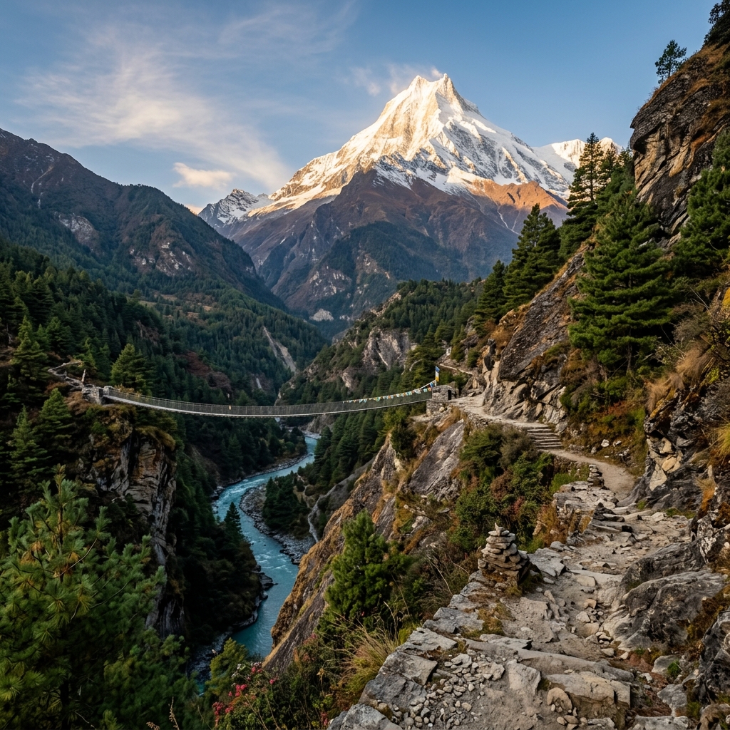
Red-and-white painted NATT footpaths traverse opposite riverbanks, pine forests, and high cliff ridges (such as Ghyaru and Ngawal), entirely bypassing the road for the vast majority of the circuit.

2. Teahouse Comfort & "Apple Pie" Luxury

❌ Myth / Expectation
"The Annapurna Circuit is a luxury lodge stroll with espresso bars, warm bakeries, and heated ensuite bedrooms everywhere."
✓ Actual Field Reality
While Manang and Marpha feature incredible apple bakeries, teahouse bedrooms above 3,500m are uninsulated plywood with zero heating. Nighttime temperatures drop to -10°C to -15°C.
🏔️

3. Thorong La Pass (5,416m) Difficulty

❌ Myth / Expectation
"Thorong La is a gentle walk-up hill that anyone with basic fitness can cross casually after a hearty breakfast."
✓ Actual Field Reality
Pass day requires a 3:30 AM alpine departure, steep scree/ice switchbacks in sub-zero gale winds, and a punishing 1,650m quad-burning descent to Muktinath.
🧭

4. Trek Direction & Clockwise Traps

❌ Myth / Expectation
"Flying to Jomsom and trekking clockwise over Thorong La from Muktinath saves time and effort."
✓ Actual Field Reality
Clockwise forces an extreme 1,650m single-day altitude leap from Muktinath (3,760m) to the pass (5,416m) — creating lethal HAPE/HACE altitude risk. Always trek counter-clockwise from Besisahar.
🛡️

5. Solo Trekking vs. 2026 Guide Rules

❌ Myth / Expectation
"I can enter the Annapurna Conservation Area completely solo without permits, check-ins, or professional guides."
✓ Actual Field Reality
Per Nepal Tourism Board (NTB) & ACAP regulations, solo foreign trekkers must be accompanied by a licensed guide/porter. ACAP checkpoints at Dharapani, Chame, and Manang strictly enforce compliance.
💎

6. The Main Trail vs. High Side Treks

❌ Myth / Expectation
"The Annapurna Circuit is just a straight line from point A to point B without any meaningful side excursions."
✓ Actual Field Reality
The true heart of the circuit lies in high side excursions: the turquoise glacial wilderness of Tilicho Lake (4,919m), ancient Braga Monastery, and Ice Lake (4,600m).

🚩 The NATT Waymarking System: How to Stay 100% Off the Road

The New Annapurna Trekking Trail (NATT) system uses standardized painted trail markers on rocks, tree trunks, and wooden poles throughout the entire conservation area:

Red & White Stripes (Main NATT Route)

Indicates the primary pedestrian footpath. Whenever the dirt road diverges, follow the red/white painted stripes on stones or bridge railings to remain on the peaceful alpine trail.

Blue & White Stripes (High Side Excursions)

Indicates alternative high-altitude ridge paths, panoramic viewpoints, and cultural side trips (such as Upper Pisang → Ghyaru → Ngawal, Tilicho Lake trail, and Ice Lake).

💡 Raj's High Route Directive: Upper Pisang → Ghyaru (3,730m) → Ngawal Master Route
Never take the lower valley jeep track between Upper Pisang and Manang. The high trail climbs steeply through pine forest up 400 vertical meters to the ancient stone-fortress village of Ghyaru (3,730m) and traverses to Ngawal (3,660m). It delivers world-class 360° panoramas of Annapurna II (7,937m), Annapurna IV (7,525m), and Gangapurna, while functioning as the mandatory "climb high, sleep low" physiological acclimatization needed to cross Thorong La safely.
Official 2026/2027 Legal Framework & Tariffs

2. 2026/2027 Regulations, Permits & Mandatory Guide Directives

The Annapurna Conservation Area (ACA) is Nepal's largest protected biodiversity sanctuary, spanning 7,629 km² under the governance of the National Trust for Nature Conservation (NTNC) and the Nepal Tourism Board (NTB). In 2026, a strict electronic tracking and check-in system operates across all mountain gateways.

Permit Document Issuing Authority 2026 Official Fee Requirement Checkpoints
ACAP (Conservation Permit) NTNC / DNPWC NPR 3,000 (~$23 USD) 100% Mandatory Dharapani, Chame, Manang, Muktinath
TIMS Card TAAN / NTB NPR 2,000 (~$15 USD) 100% Mandatory Besisahar Entry Gate, Dharapani
Nar-Phu Valley RAP Dept of Immigration $100 / wk (Autumn) · $75 (Spring) Conditional (Side Trek) Koto Checkpoint
⚠️ Mandatory Guide Directive Compliance Notice
Independent foreign trekkers cannot enter the Annapurna Conservation Area without a licensed trekking guide certified by the Nepal Tourism Board. Permits issued in Kathmandu or Pokhara require an agency endorsement and guide registration number.
14-Day Day-by-Day Field Itinerary & Acclimatization Science

3. 14-Day Gold Standard Acclimatization Itinerary

Rushing the Marsyangdi ascent is the primary reason unprepared trekkers fail to cross Thorong La Pass. Best Treks Nepal's 14-Day Gold Standard Itinerary incorporates two strategic acclimatization checkpoints in Manang and Yak Kharka, enforcing the high-altitude law: "Climb high, sleep low, and never exceed 500 meters of net sleeping elevation gain per day above 3,000m."

Day 1 Drive Kathmandu / Pokhara to Besisahar & 4WD to Dharapani (1,860m) 1,860m · 8 hrs Transit
Depart along the Prithvi Highway to Besisahar (760m), then transfer to a rugged 4WD Scorpio jeep along the Marsyangdi gorge into Dharapani.
Start Alt
1,400m (KTM)
Night Alt
1,860m (Dharapani)
Transit
8–9 hrs
Stay
Mountain Lodge
💡 Trail Tip: Register ACAP & TIMS permits at the Dharapani entrance checkpoint.
Day 2 Dharapani to Chame (2,670m) 2,670m · 15.5 km · 5–6 hrs
Hike through fragrant pine, oak, and rhododendron forests along the Marsyangdi River. Ascend through Bagarchhap and Timang (2,270m) for vistas of Mount Manaslu (8,163m) before arriving in Chame.
Start Alt
1,860m
Night Alt
2,670m
Net Gain
+810m
Distance
15.5 km
Day 3 Chame to Upper Pisang (3,300m) via Paungda Danda Rock Face 3,300m · 14.0 km · 5 hrs
Traverse spruce forests and behold the staggering 1,500m curved rock face of Paungda Danda. Cross into the arid upper valley to Upper Pisang.
Start Alt
2,670m
Night Alt
3,300m
Net Gain
+630m
O2 Level
~70% Eff O2
Day 4 Upper Pisang to Manang (3,540m) via Ghyaru (3,730m) & Ngawal 3,540m (Peak 3,730m) · 18.0 km · 7 hrs
Climb to medieval Ghyaru (3,730m) for unmatched panoramas of Annapurna II and IV, traverse high ridgelines to Ngawal and ancient Braga Gompa into Manang.
Start Alt
3,300m
High Point
3,730m (Ghyaru)
Night Alt
3,540m (Manang)
Distance
18.0 km
Day 5 Mandatory Acclimatization Day in Manang (Chongkor / Gangapurna Lake) 3,540m · Active Rest
Hike to Chongkor Viewpoint or Gangapurna Glacial Lake (3,800m). Attend the 3:00 PM altitude safety briefing at the Himalayan Rescue Association (HRA) clinic.
Day Hike
3,850m
Sleep Alt
3,540m
Activity
Glacial Lake
Clinic
HRA Briefing
Day 6 Manang to Yak Kharka (4,050m) 4,050m · 10.0 km · 4 hrs
Ascend into alpine tundra along the Jarsang Khola where blue sheep and yaks graze. Arrive in Yak Kharka with plenty of rest time.
Start Alt
3,540m
Night Alt
4,050m
Net Gain
+510m
O2 Level
~62% Eff O2
Day 7 Yak Kharka to Thorong Phedi (4,450m) / High Camp (4,880m) 4,450m / 4,880m · 7.0 km · 3.5 hrs
Cross the suspension bridge at Ledar and traverse scree slopes to Thorong Phedi or High Camp. Early dinner and 7:30 PM bedtime.
Start Alt
4,050m
Night Alt
4,450m / 4,880m
O2 Level
~57% Eff O2
Wake Up
3:00 AM
Day 8 Cross Thorong La Pass (5,416m) & Descend to Muktinath (3,760m) 5,416m Pass · 16.0 km · 8–9 hrs
3:30 AM departure under headlamps. Reach the summit of Thorong La (5,416m) with prayer flags and vistas of Dhaulagiri (8,167m). Descend 1,650m to Muktinath.
Pass Alt
5,416m
Night Alt
3,760m
Descent
-1,656m
Trek Time
8–9 hrs
Day 9 Muktinath to Marpha (2,670m) via Kagbeni & Jomsom 2,670m · 19.0 km · 6 hrs
Visit sacred Muktinath Temple, descend through medieval Kagbeni into the whitewashed stone village of Marpha, the apple capital of Nepal.
Start Alt
3,760m
Night Alt
2,670m
Culture
Thakali & Mustang
Highlight
Apple Bakeries
Day 10 Marpha to Tatopani (1,190m) through the Deepest Gorge 1,190m · Hot Springs
Descend the Kali Gandaki canyon between Dhaulagiri and Annapurna I, arriving in Tatopani to soak in riverside natural thermal hot springs.
Start Alt
2,670m
Night Alt
1,190m
O2 Level
~88% Eff O2
Recovery
Hot Springs
Day 11 Tatopani to Ghorepani (2,860m) — The Rhododendron Ridge 2,860m · 17.0 km · 6–7 hrs
Ascend through terraced Gurung and Magar farmlands into the world's largest rhododendron forest to Ghorepani.
Start Alt
1,190m
Night Alt
2,860m
Net Gain
+1,670m
Terrain
Rhododendrons
Day 12 Poon Hill Sunrise (3,210m) & Trek to Ghandruk (1,940m) 3,210m Sunrise · 14.0 km · 6 hrs
Pre-dawn climb to Poon Hill (3,210m) for panoramic sunrise over Dhaulagiri and Machapuchare, then hike to the Gurung stone village of Ghandruk.
Sunrise Alt
3,210m
Night Alt
1,940m
Culture
Gurung Museum
Vistas
Machapuchare
Day 13 Ghandruk to Birethanti & Private Transfer to Pokhara (820m) 820m · 3 hrs Trek + 1.5 hrs Drive
Descend stone stairs to Birethanti, board private transport to your lakeside hotel in Pokhara for a celebratory dinner.
Start Alt
1,940m
End Alt
820m (Pokhara)
Trek Days
13 Completed
Stay
Lakeside Hotel
Day 14 Pokhara Relaxation & Scenic Drive / Flight to Kathmandu (1,400m) 1,400m · 25 min Flight / 6 hrs Drive
Relax beside Fewa Lake, followed by a panoramic mountain flight or tourist transfer back to Kathmandu.
Start Alt
820m (Pokhara)
End Alt
1,400m (KTM)
Flight
25 min Flight
Status
100% Complete
💰 2026/2027 Financial Blueprint

4. Real 2026 Cost Breakdown: Independent vs. Guided Packages

Budgeting for the Annapurna Circuit requires understanding the economic principle of "Altitude Price Escalation." While roads reach Chame and Muktinath, fuel and mule transport directly inflate prices as you ascend towards High Camp (4,880m).

Expense Component Guide-Only Package Best Treks Standard (Best Value) Luxury VIP Expedition
Base Trip Cost $850 – $1,050 USD $1,150 USD (All-Inclusive) $1,950 – $2,600 USD
Transport Public bus / shared jeep Private 4WD Scorpio Jeep Private 4WD + Flight
Lodging & Meals Pay-as-you-go ($40/day) Included (3 meals + rooms) Ensuite rooms wherever available
Guide & Porter Mandatory Guide only Licensed Guide + Porter Senior Lead Guide + 1:1 Porter
Permits & First Aid $40 USD (Self-arranged) ACAP + TIMS + Medical Kit All Permits + Oxygen + Heli SOS

Interactive 2026 Annapurna Budget Calculator

Select your preferred expedition tier to calculate realistic total costs:

Add Optional Trail Extras:
Estimated Expedition Cost
$1,150 USD
Recommended Cash in Kathmandu:
Carry ~$300 USD (NPR 40,000) in Cash
5,416m Alpine Hazard Protocols

5. Thorong La Pass (5,416m) Anatomy & Altitude Safety

At 5,416 meters, Thorong La is the highest navigable pass on Earth. Effective atmospheric oxygen drops to 51% of sea level. A safe crossing requires disciplined pacing, hydration, and adherence to medical protocols.

🩺 Interactive Lake Louise AMS Self-Assessment

Clinical scorecard used by Himalayan Rescue Association.

0
Normal Adaptation
1. Headache Severity
2. Gastrointestinal Symptoms
3. Fatigue / Weakness
4. Dizziness / Lightheadedness
✅ Clinical Assessment: Normal Adaptation (Score: 0)
Your body is adapting normally. Drink 4–5L of water and maintain an easy pace.
10 Field Realities & Sherpa Protocols

6. "What No One Tells You" — 10 Uncensored Annapurna Secrets

Insider secrets every seasoned Sherpa guide knows, but rarely appear in standard commercial brochures:

01
Critical

The Khumbu Cough Strikes Annapurna

Dry, freezing air above 3,500m irritates vocal cords and triggers violent coughing fits that can tear intercostal muscles.

Sherpa Protocol: Wear a Buff over mouth and nose from Chame onward to humidify breath.
02
Critical

Mule Trains Own the Mountain Right-of-Way

Heavily loaded mule trains carry hundreds of kilograms of cargo and cannot brake abruptly on narrow trails.

Sherpa Protocol: Always stand on the mountain/cliff side, never the valley/precipice side.
03
Essential

Sub-Zero Teahouse Bedrooms

Lodge bedrooms have uninsulated plywood walls and zero heating. Night temps drop to -15°C.

Sherpa Protocol: Bring a -15°C down sleeping bag; do not rely solely on teahouse blankets.
04
Recommended

Lithium Battery Drain in Alpine Cold

Cold temperatures rapidly deplete smartphone and camera batteries overnight.

Sherpa Protocol: Keep electronics and power banks inside the toe-box of your sleeping bag.
Himalayan Meteorological Windows

7. Best Seasons & 12-Month Climate Analysis

Timing determines trail conditions, mountain visibility, and pass safety across the Annapurna Massif.

Peak Season (Sep – Nov)

Autumn: Crystal Skies & Stability

Day Temp: 12°C to 18°C
Pass Temp: -10°C to -15°C
Visibility: 98% Clear
Crowds: High

The gold standard trekking window with post-monsoon crisp air and panoramic views.

Prime Season (Mar – May)

Spring: Rhododendrons & Warmth

Day Temp: 14°C to 20°C
Pass Temp: -6°C to -12°C
Flora: Blooming Forest
Crowds: Moderate

Warm days, blooming rhododendrons in Ghorepani, and comfortable climbing temperatures.

4-Layer Alpine Defense & Weight Matrix

8. 4-Layer Gear & Interactive Packing Checklist

Weight discipline is critical for high-altitude trekking. Porters carry up to 12 kg in your main duffel, while you carry 5–6 kg in your daypack.

🎒 Daypack Allocation (5–6 kg)

Water bottles, rain shell, down jacket, sunglasses, passport, cash, and medical essentials.

🧳 Porter Duffel Allocation (10–12 kg)

Sleeping bag, thermal base layers, spare boots, camp clothes, and heavy toiletries.

Interactive Packing Checklist (36 Items)

0% Packed
Check off items as you pack. Your progress is saved automatically!
Frequently Asked Questions

9. Frequently Asked Questions (FAQ)

Answers to the most common questions regarding the Annapurna Circuit:
Is the Annapurna Circuit harder than Everest Base Camp?
Both treks are rated 4 / 5 (Strenuous). EBC keeps you at high altitudes for longer, but Thorong La Pass (5,416m) is higher than EBC and requires a steeper descent.
Can complete beginners trek the Annapurna Circuit?
Yes. It requires zero technical climbing. Beginners with good baseline cardiovascular fitness who train 8–12 weeks in advance routinely succeed.
Is a licensed guide legally mandatory in 2026?
Yes. Under Nepal Tourism Board rules, all foreign trekkers must be accompanied by a licensed guide registered with an authorized agency.